
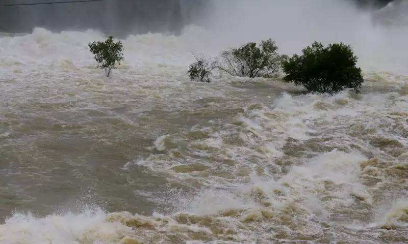
2017 is an extraordinary year, Hunan flood, Xiangjiang River, water, Yuanshui three streams and Dongting Lake District, a total of 24 water level alarm water level. 20:20 at 20:20 on July 2, Xiangjiang Changsha station water level reached 39.49 meters, compared with the highest water level in 1998 is still higher than the 0.31 meters, so accurate and timely data, how quickly know that the radar level Water monitoring and early warning system can help.
Application background
China is a water disaster-prone areas, each year will cause huge losses of personnel and property. Over the past few decades, China has basically established to cover the country more than rivers and lakes, lakes, hills, group defense network, the establishment of hundreds of large and small monitoring stations, with a large number of group of anti- The monitoring team effectively controls the loss caused by the water disaster to a minimum. But there are still many problems, there are still weak water monitoring system, the degree of information is not high, data collection, update is not timely, narrow coverage of information and other issues, water monitoring area equipment has not yet networked, did not form a real-time dynamic monitoring system, It is difficult to meet the flood, dam collapse, debris flow and other timely warning, rapid response, rapid transfer, effective hedging emergency response needs.
With the deep study of water disasters and found that the need to use more high-tech means of the possible disaster areas, key areas to form a full-time, three-dimensional monitoring and early warning. Based on the radar level gauge water conservancy disaster monitoring and early warning system combines radar technology, wireless sensor networks, broadband mobile communication technology and other high-tech.
Solution
The system uses the radar for water level measurement. It can collect, process, calculate and store the water level change information in real time through the communication channel (including mobile phone, serial port, etc.). The monitoring center realizes the received water level information to predict and send flood , Debris flow, dam dike and other accident alerts, in order to achieve the prediction of disaster evolution and prevention process development dynamic purposes.
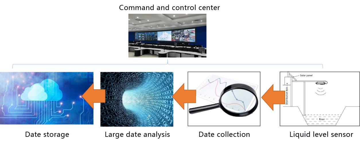
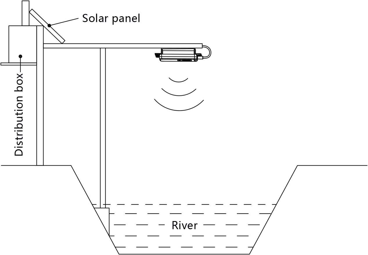
The radar level meter emits a very low microwave pulse through the antenna RF system. When the emitted electromagnetic wave encounters the surface of the measured medium, the emitted electromagnetic waves are reflected to form an echo and return to the radar receiving device along the same path. As the electromagnetic wave propagates at the speed of light, the distance between the transmitting device and the surface of the measured medium is proportional to the propagation time of the pulse, and the liquid level information can be obtained by calculating the time difference between the transmission and reception of the electromagnetic wave. These levels of information through the wireless and wired communication network to the monitoring center for decision-makers reference.
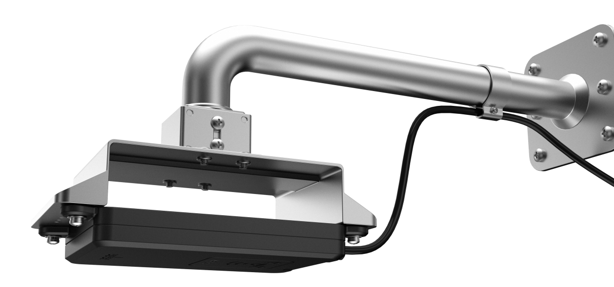
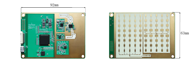
Level gauge based on millimeter wave radar
Nanoradar Millimeter Wave Radar Level Sensor
Advantages
1. Radar level gauge from temperature, humidity, space propagation media, wind speed, rainfall and other environmental factors, to achieve all-day, all-weather work;
2. Radar level gauge measurement accuracy, can reach millimeter-level measurement accuracy;
3. The entire monitoring and early warning system with real-time, wide range of features, can complete a variety of monitoring functions;
4. Water Disaster Monitoring and Early Warning System Realizes all-digital, fully decentralized, fully open, interoperable and networked monitoring and warning functions for water disaster.
Application areas
Water conservancy, the system can complete the monitoring of water disaster, river and lake flood warning and other functions.
On the municipal side, the system can be used as a sewer level monitoring system, which will help deal with many problems caused by urban storm raids.
On the industrial side, the system can be used for liquid level measurement of crude oil in oil tanks, as well as liquid level monitoring in general industrial processes.
In addition, the product can also be based on the user's different functional needs to be modified, which can be applied to environmental protection, weather and other potential areas or industries.