
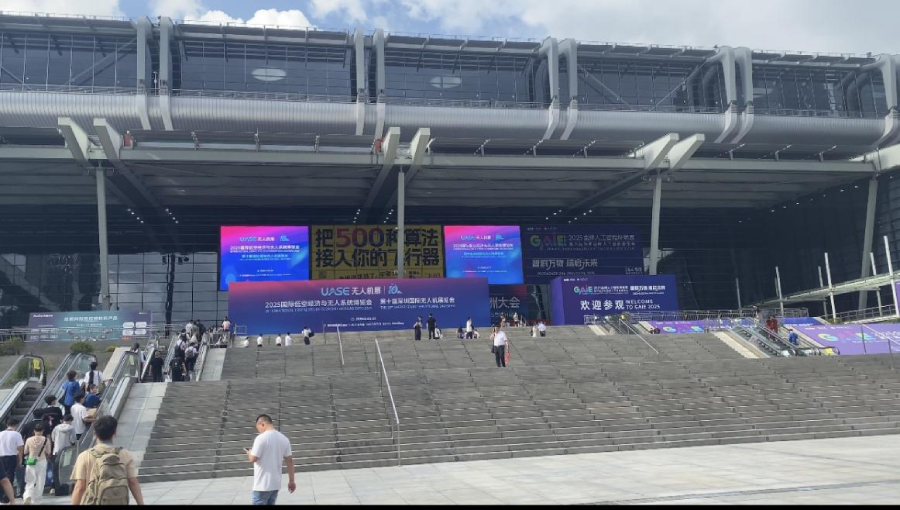
As a top player in the drone radar industry, Nanoradar showcased its latest 3000m altimeter, altitude-holding, and obstacle-avoidance radars at booth 1C352, under the theme "Precision Detection · Intelligent Perception."

The booth was surrounded all day by domestic and international clients, industry experts, and media, with excitement reaching new heights. Some overseas customers even made on-the-spot purchases of drone radars, highlighting the immense potential of the global drone industry and the growing demand for perception technologies.
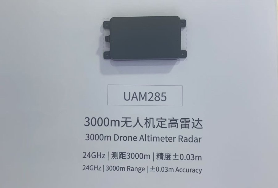
Exhibition Zone: Global Debut of the Latest 3000m Altimeter
At the expo, Nanoradar unveiled its newly released UAM285 altimeter radar, featuring a stable detection range of ≥3000m and a precision of ±0.03m.
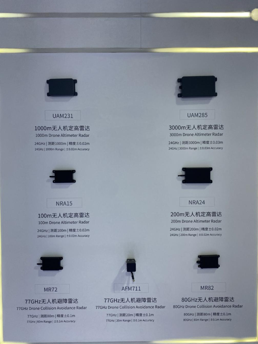
Nanoradar's drone radar products cover altitude-holding and obstacle-avoidance applications, with dual-beam detection and three frequency bands (24G/77G/80G). They support three-range switching (30/100/200 meters) and achieve a distance measurement accuracy of 0.02m, seamlessly integrating with the world's two major open-source flight control platforms (PX4 & APM).
The products have obtained at least six international certifications, are sold in over 20 countries, and have reached 100,000 units in sales, proving their reliability in real-world applications.
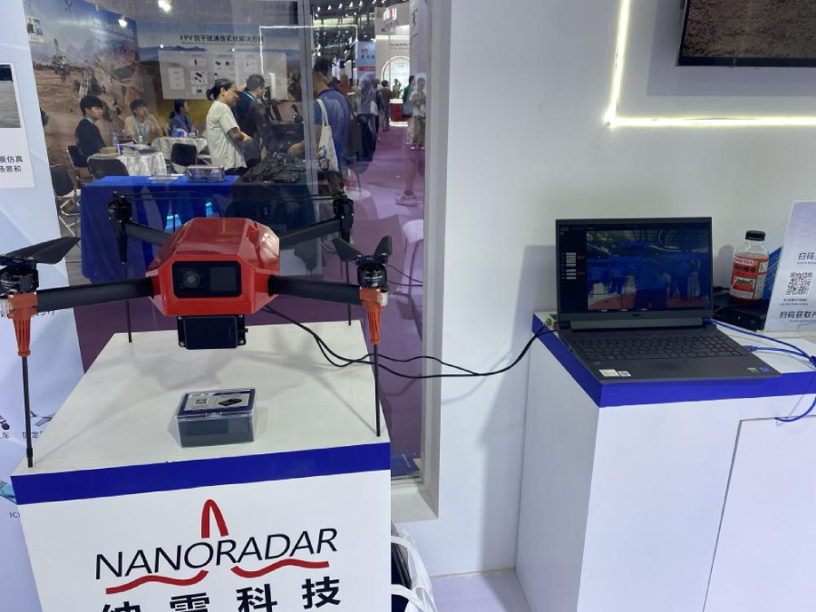
Demo Zone: Live Demonstration of Radar-Vision Fusion System
In the application demo zone, a quadcopter drone equipped with Nanoradar's radar-vision fusion system detected approaching visitors in real time, displaying target imaging, distance, and type information on a computer screen.This product integrates radar and camera systems, fusing radar data with visual data and transmitting it to the remote controller screen. It not only saves space but also reduces operational complexity, precisely meeting the drone industry's core needs for efficient perception and spatial optimization.

Scenario Zone: 720° Full Protection for Safer Flights
In the scenario demo area, a drone equipped with three radars (top, front, and bottom) demonstrated anti-collision, obstacle avoidance, and altitude-holding capabilities, providing 720° full-coverage protection:Top radar: Monitors high-altitude obstacles (e.g., cables, buildings) in real time, with a height warning error of just 0.1m.
Front radar: Features a dual-beam design, detecting targets up to 80m ahead for safer obstacle-avoidance flights.
Bottom radar: Offers 3000m ultra-long-range detection with ±0.02m precision for terrain-following altitude control, suitable for takeoff, landing assistance, and high-altitude inspections.